
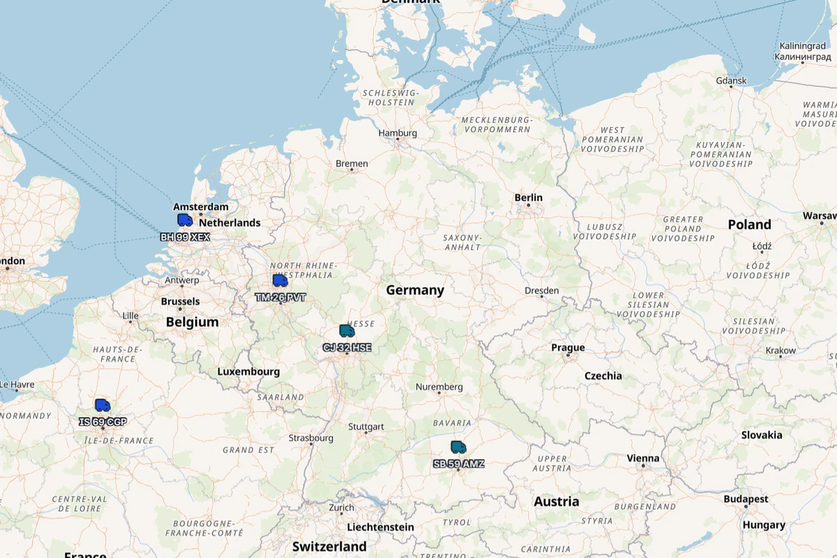
Can you add a TMS without replacing your GPS service?
Yes, when the exact provider, active service, relevant equipment and agreed commercial scope are compatible with the available integration. Compatibility must be confirmed for your company; using a GPS service today does not guarantee that it connects to every TMS.
Your agreement with the telematics provider remains separate. The GPS platform continues to supply vehicle positions, while the TMS can place supported data beside vehicles, transport jobs and the dispatcher’s operating view.
Routena’s current terms state that GPS integrations cover providers supported at the relevant time and do not guarantee any particular connection. The current proposal and a demonstration with your setup are therefore decisive.
What stays with the telematics provider, and what appears in the TMS?
| With the telematics provider | In the TMS |
|---|---|
| the monitoring-service agreement | the vehicle matched to received data |
| the active service and equipment, when their compatibility is confirmed | the latest available position on the map |
| the platform producing and transmitting location data | status and direction where the selected integration or configuration supports them |
| support for the equipment and source position | operating context for fleet and transport work |
Routena’s product overview documents position, status and direction on the monitoring map. Its information about telematics providers explains that the customer maintains the direct relationship with the tracking service. Integration does not automatically transfer that agreement or require new equipment. Continuing with the existing service and equipment still depends on exact compatibility.
How does a vehicle position reach the TMS map?
- The vehicle sends a position to the company’s GPS service.
- The provider platform receives the available data.
- A compatible connection makes the agreed data available to the TMS.
- The TMS matches the information to the correct vehicle and displays the latest received value on the map.
GPS and TMS remain separate layers. The fleet record-keeping guide also explains where the administrative fleet register fits between them.
What does live fleet tracking mean?
Do not interpret live as a perfect, instantaneous position under every condition. Check three separate layers:
- Position quality at the source. Signal, surroundings and equipment can affect a position. GPS.gov describes these general factors.
- Delivery of newer data. Coverage or an unavailable third-party service can temporarily interrupt updates.
- The latest displayed information. A TMS can show only data it has received. Ask what any visible timestamp represents; when no timestamp is exposed, do not infer how recent the position is.
The following labels can help your team evaluate freshness. They are not Routena interface states and have no universal time thresholds:
| Evaluation | What it means for dispatch |
|---|---|
| Current | the latest information falls within the company’s acceptable window for that decision |
| Delayed | information exists, but its age requires confirmation before use |
| Unavailable | no position is recent enough for the current decision |
Define acceptable age for each kind of decision based on the tracking service and the pace of your operation.
What should you verify before enabling the integration?
- Exact compatibility. Confirm the provider, active service, relevant equipment and inclusion in the proposal.
- Vehicle matching. Registration numbers or identifiers must connect each position to the correct vehicle.
- Available fields. Verify the position and any other information supported by the selected configuration.
- Timestamp meaning. Ask whether a timestamp is visible and which event it records: source position, data receipt or another moment.
- Missing or old data. Operators must avoid confusing the last known value with one recent enough for the decision.
- Investigation ownership. Decide who first checks the source service and who checks matching or display in the TMS.
For integration evaluation more broadly, use the TMS selection criteria.
Which scenarios should you run in the demo?
Use synthetic or effectively anonymised data and run the same cases across a few representative vehicles.
| Scenario | What to verify |
|---|---|
| Normal trip | correct vehicle, position, available fields and timestamp meaning |
| Weak signal or difficult coverage area | the position is not treated as perfect and the operator knows when confirmation is needed |
| New data delayed or unavailable | the last known value does not masquerade as current and an investigation owner is identified |
| Missing or mismatched vehicle | the problem can be found and the association corrected before operational use |
Record the result rather than noting only that the map opened:
| Expected result | Actual result | What the displayed time represents | Owner | Verdict |
|---|---|---|---|---|
| vehicle and position are correct | complete during demo | confirm during demo | GPS provider / TMS provider / customer | pass / fail |
What does a TMS-GPS integration not solve automatically?
Integration does not guarantee:
- compatibility with every provider or device;
- perfect source-position accuracy;
- new data during an interruption of the source service;
- unconditional retention of every installed device;
- functions or fields outside the agreed configuration.
A convincing map in a presentation is therefore not enough. Test the source, vehicle match, freshness and the case where an update does not arrive.
When should you keep your current provider?
Keep the current GPS service when:
- compatibility is confirmed for the service and equipment in use;
- source data is good enough for the company’s decisions;
- the TMS map adds useful dispatch context;
- timestamps and missing updates can be interpreted correctly;
- responsibility between your company and both suppliers is clear.
Reassess the configuration when it is incompatible, vehicles cannot be matched reliably, data is repeatedly unusable or the team cannot judge how recent the information is.
Do not choose on the phrase “GPS integration available.” Ask for your exact combination to be demonstrated and confirm the configuration in which the integration is available in the current proposal.